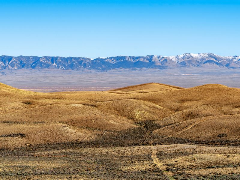
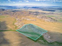
Mountain View Bordering Public Land
County Road 63 : Rawlins, WY 82301
Sweetwater County, Wyoming
Farm Description
Property Description
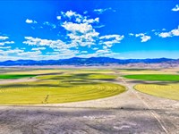
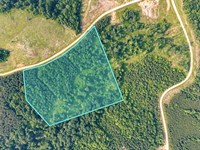
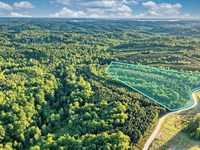
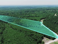
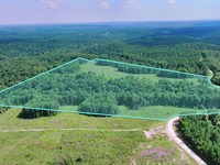
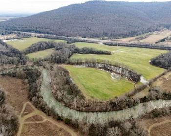
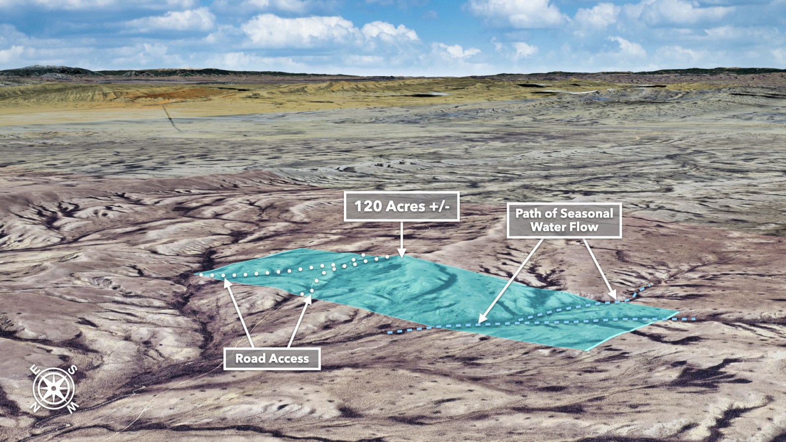
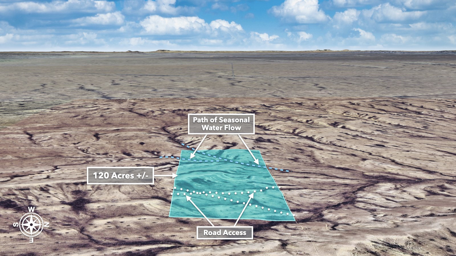
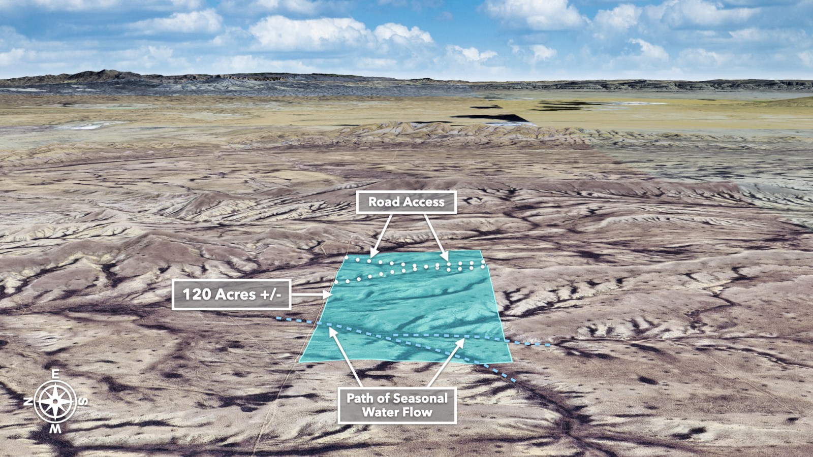
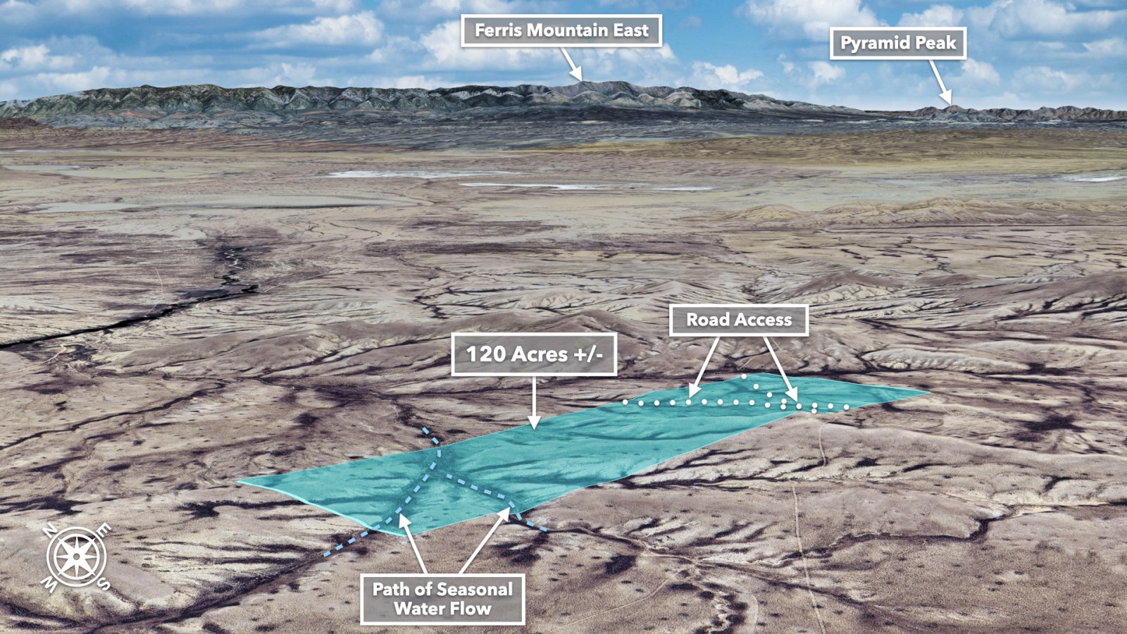
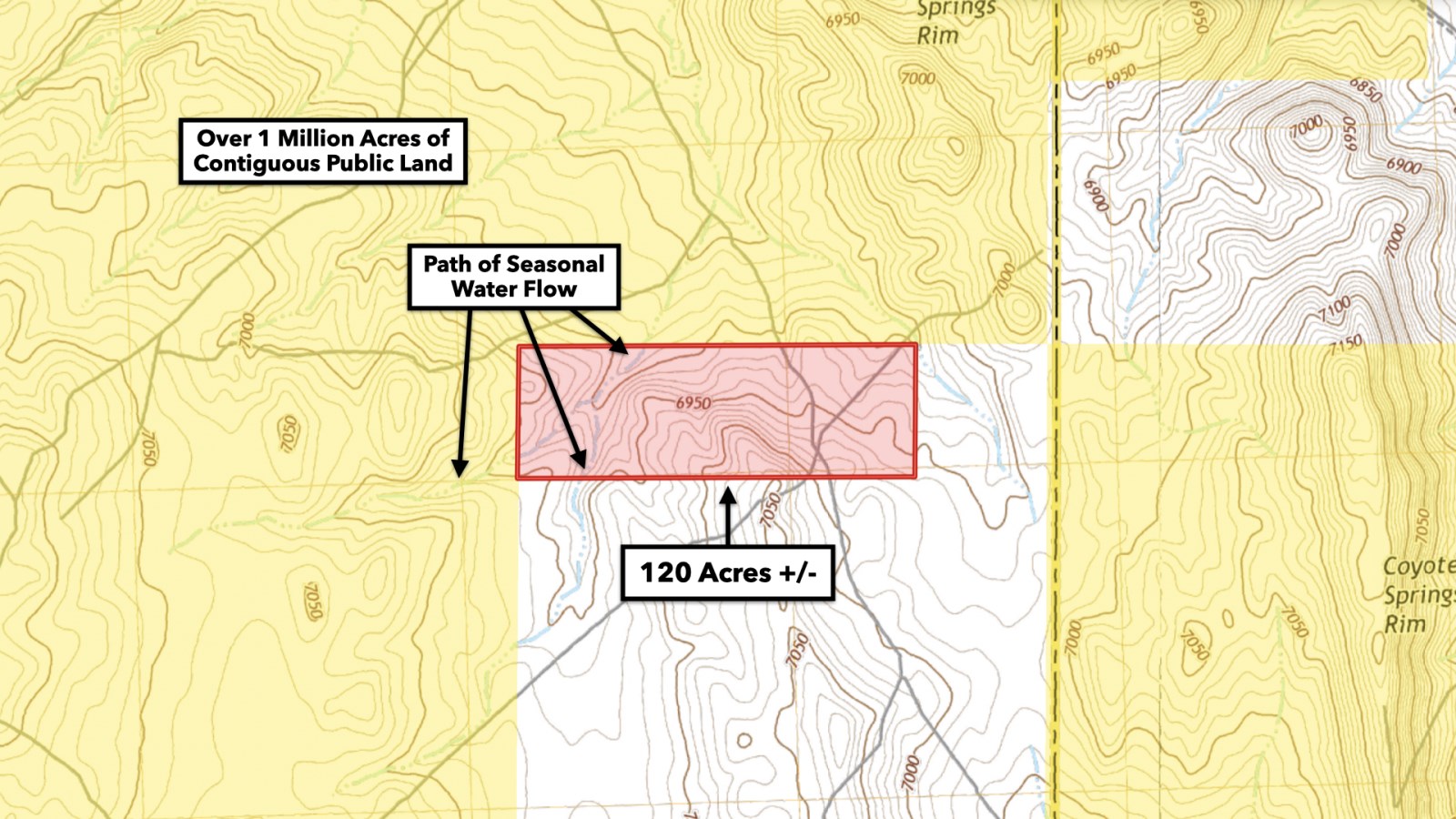
Embrace Wyoming's cowboy culture or enjoy a scenic retreat in Wyoming's high plains with views of the rolling foothills beyond. This rustic 120 Acre property in the high plains of Sweetwater County, Wyoming with No HOA or HOA fees and low property taxes.
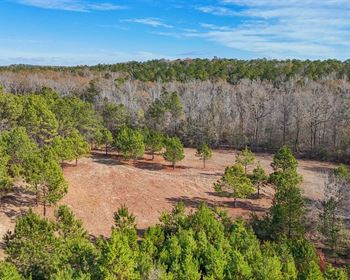
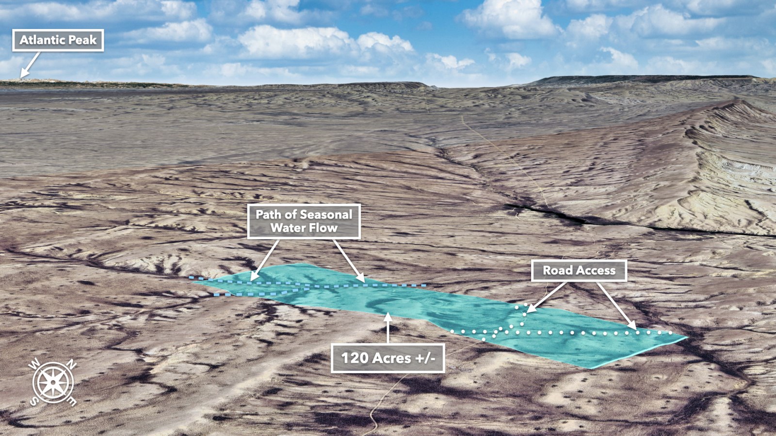
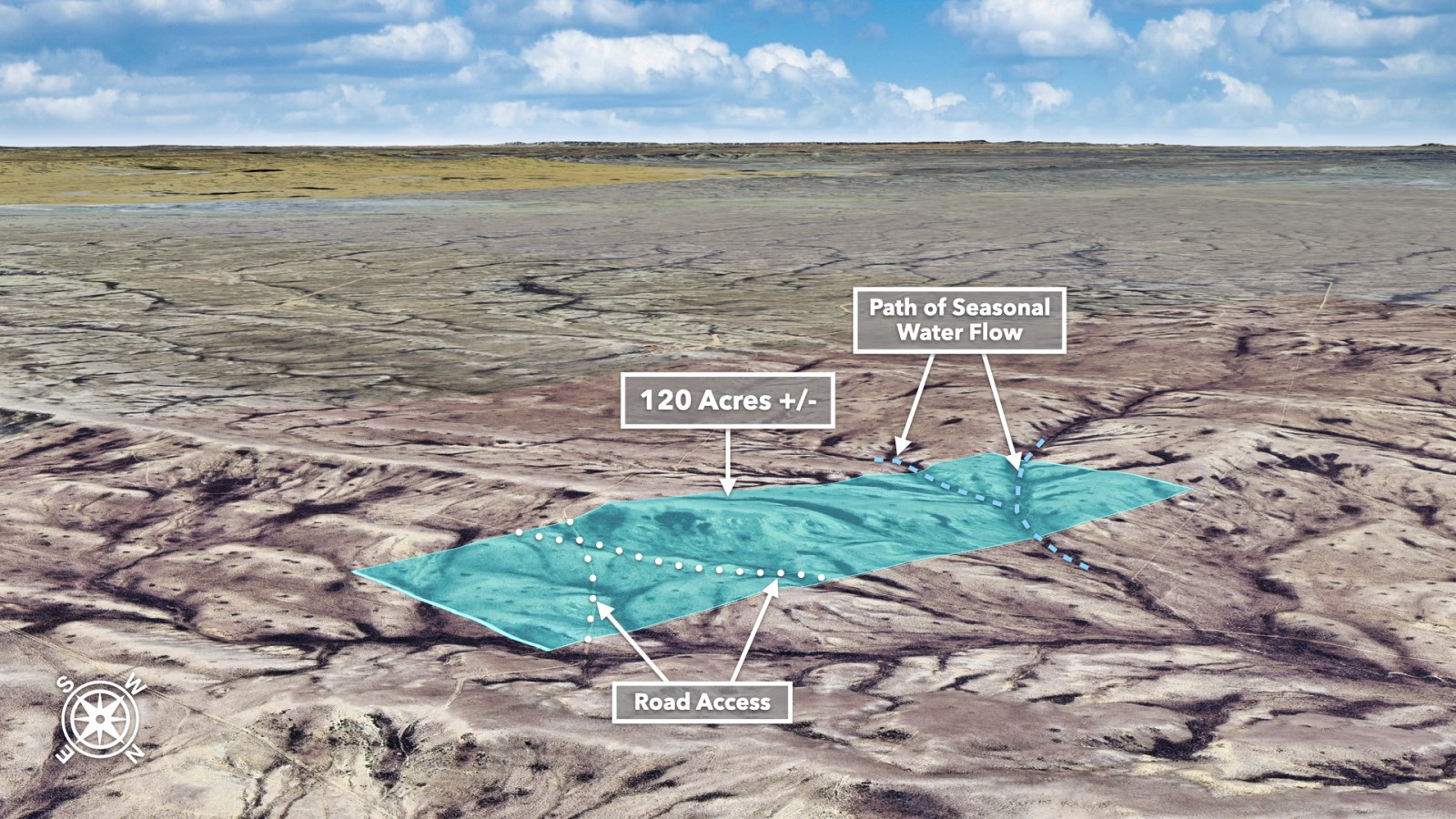
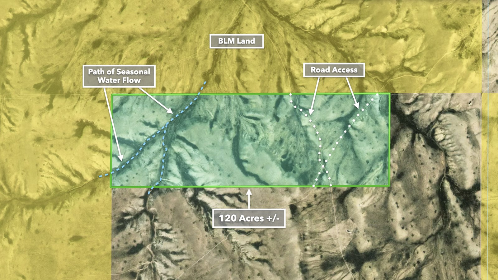
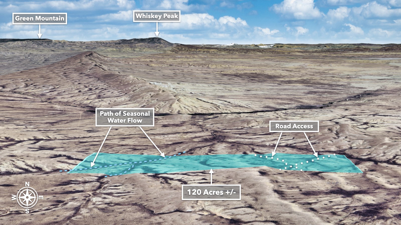
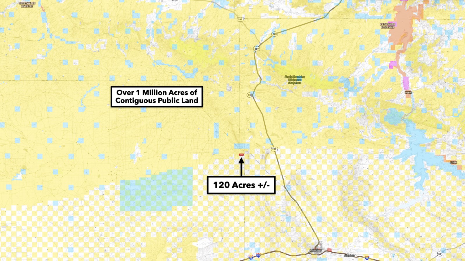
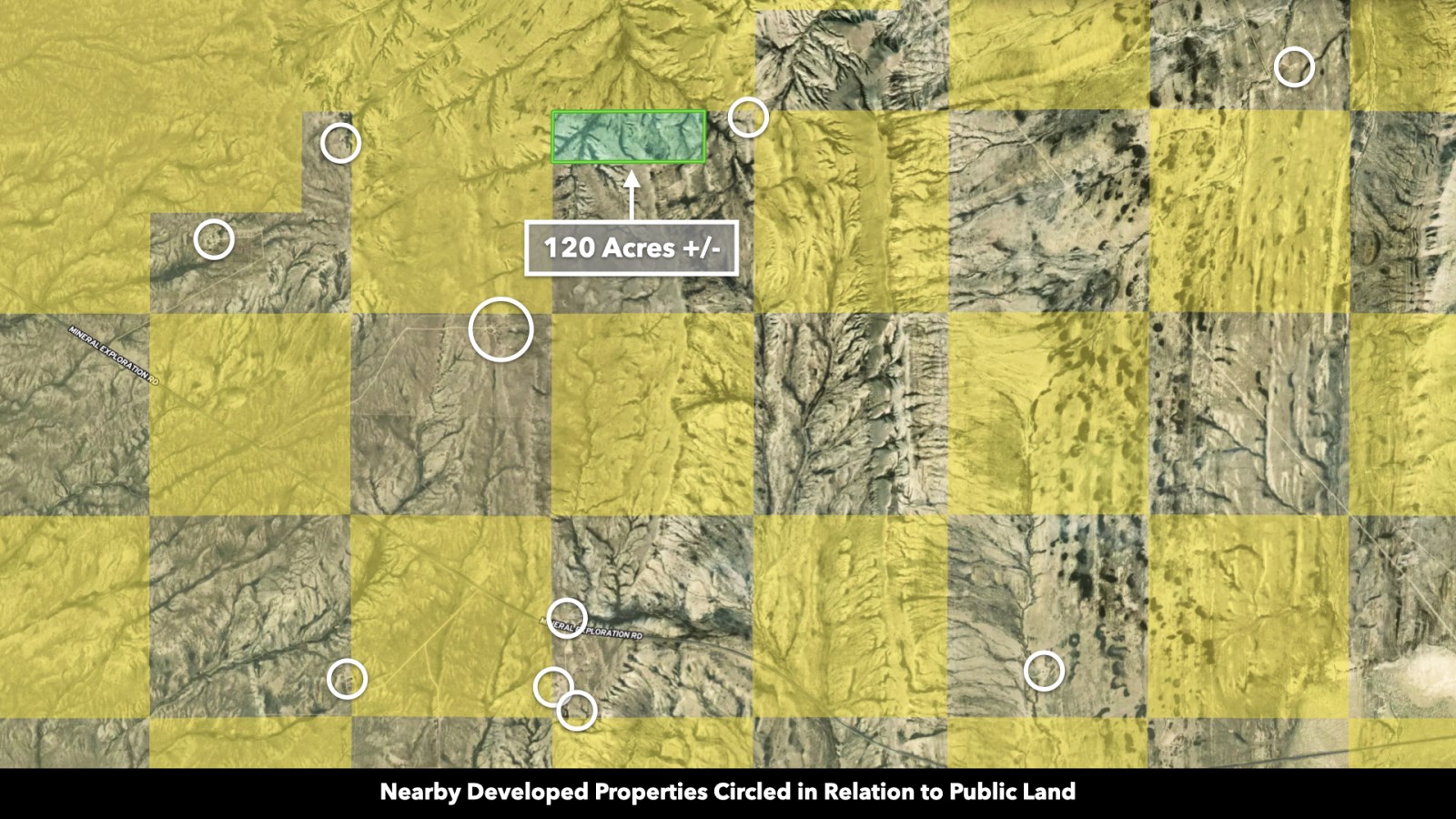
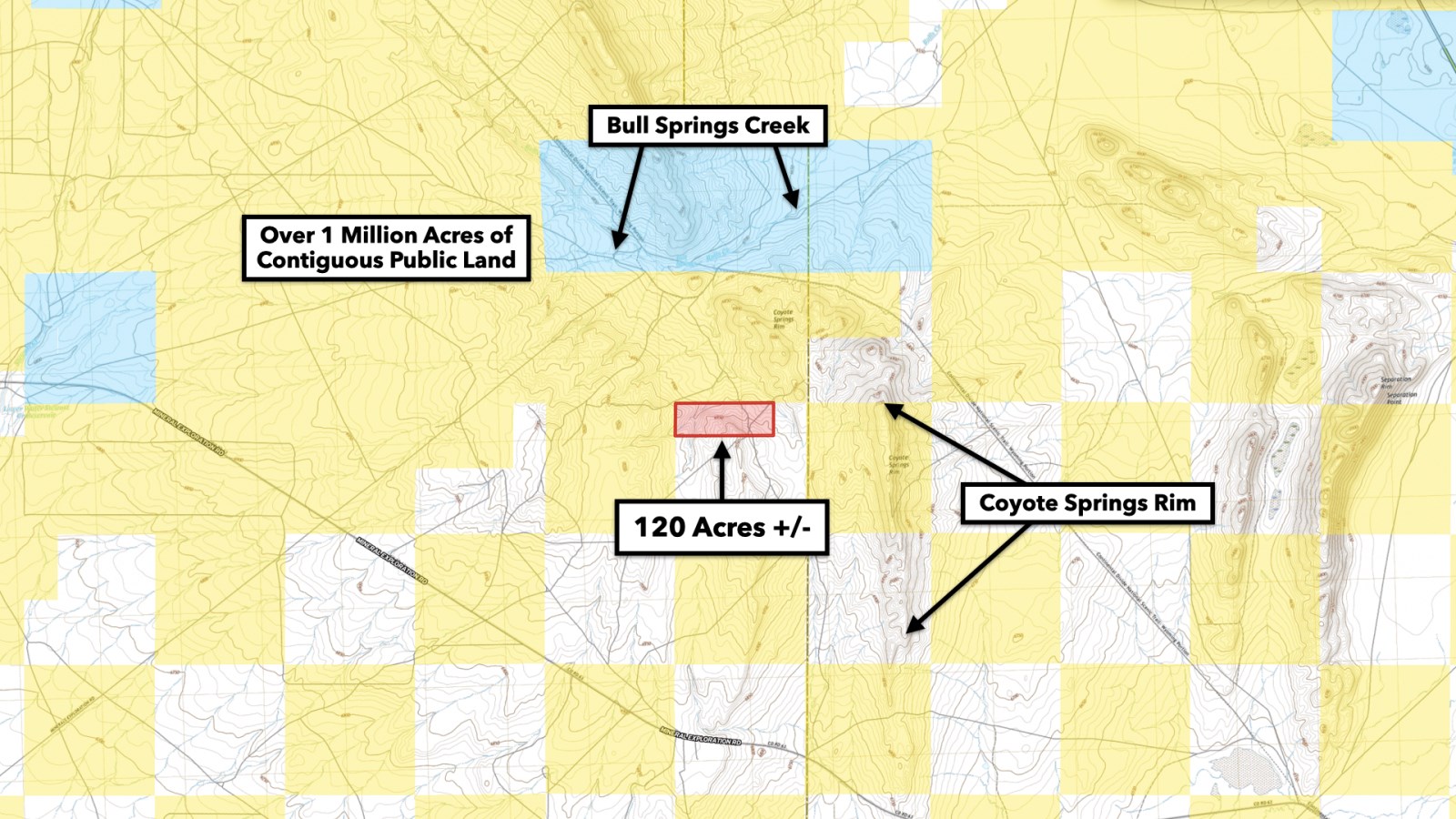
This property offers room to roam. The property borders over a million Acres of BLM land along the entire North and West boundary. This public land stretches contiguously all the way to the Green Mountain, Whiskey Peak, Seminoe State Park, and much more. Some of the mountain features that can be seen from the property are Bradley Peak, the Ferris Mountains, and the Bull Springs Rim.
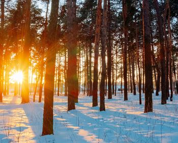
Most of the surrounding BLM land is open for ATV adventures, dispersed camping, hiking, biking, horseback riding, wildlife viewing, hunting, and fishing (if a water source is available). Stargazing in the Cowboy State is unparalleled. The Milky Way seems close enough to touch without light pollution hindering its brilliance.
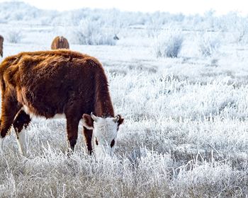
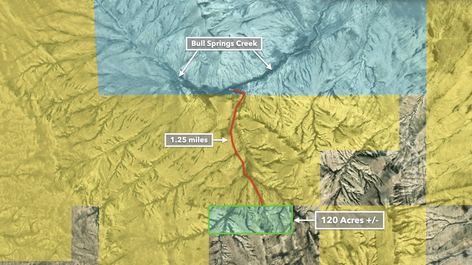
This area is incredibly rich in wildlife due to Bull Springs, located only 1 mile North of the property. Just in the short time these photos were taken, Wild Horses, Antelope, and Wild Turkey were seen on and around the property.
Known for its prosperous ranches and expansive farmland, Wyoming still stands as the least populated state in the US, meaning more space, freedom, and privacy for the residents who call this state home.
Almost half of Wyoming is protected and uninhabited. According to the Bureau of Land Management, “The BLM manages more than 18.4 Million Acres of Public Lands and 40.7 Million Acres of federal mineral estate in Wyoming. Blm-Managed lands in Wyoming contain world-class energy and mineral resources that are crucial to the nation (Blm).” The BLM promises to protect and “manage these lands for today's enjoyment and the benefit of future generations (Blm Wyoming).”
Pair that with 12 breathtaking parks like Yellowstone National Park, and this State has some of the most pristine and natural beauty in the nation.
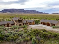
There are several ranches and farms with homes nearby.
This property is zoned Agricultural and there are several ranches and farms with homes nearby. Sweetwater County's Zoning Resolution shows that site-built, modular, mobile and manufactured homes are permitted along with accessory structures. The land can be used for commercial and/or non-commercial farming and ranching.
Accessibility
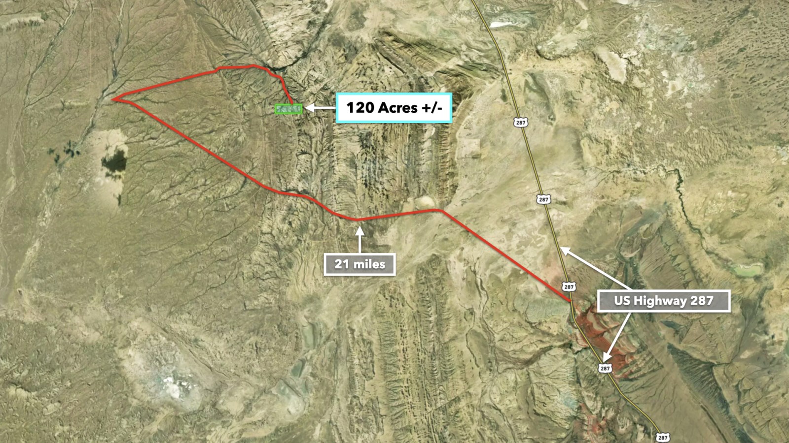
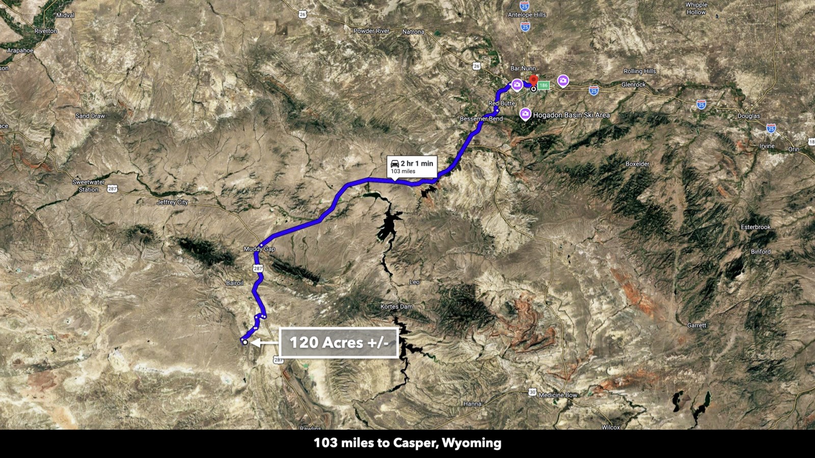
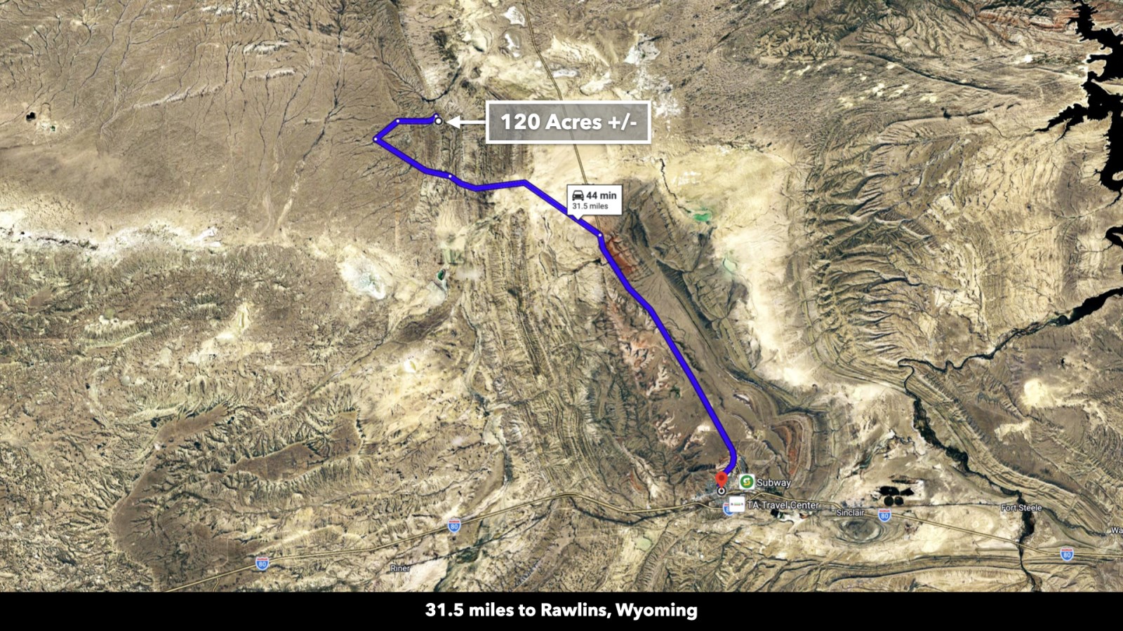
The property has dirt road access which connects to County Road 63 (which is also known as Minerals Exploration Road) and which connects to US Highway 287. Take 287 south into Rawlins or North into Casper. Both cities have restaurants, grocers, and professional and medical services available.
The property is also about a 2 hour drive from Casper International Airport.
Wyoming Wild Horse Adoption Program
Some nearby BLM land includes Wild Horse Herd Management Areas. White Mountain HMA is one of the closest HMAs to the property. The Rock Springs Field Office offers 2.5-Hour tours to see the horses and enjoy scenic overlooks at Pilot Butte, Killpecker Sand Dunes, Overland Trail, the Union Pacific Railroad Corridor, and more. Wild horses are also available for adoption.
Hunting, Fishing, & Recreation
Wildlife roams freely here in the high plains. Mule deer and pronghorn antelope graze on native vegetation; you'll see their tracks throughout the property. Majestic bald eagles soar overhead, looking for small prey on the plains.
Wyoming is home to a variety of wildlife inhabitants. In other parts of the state, big horn sheep, mountain goats, bison, mountain lions, wolves, grizzly and black bears, elk, and moose mark their territory in the mountains and foothills.
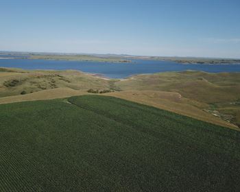
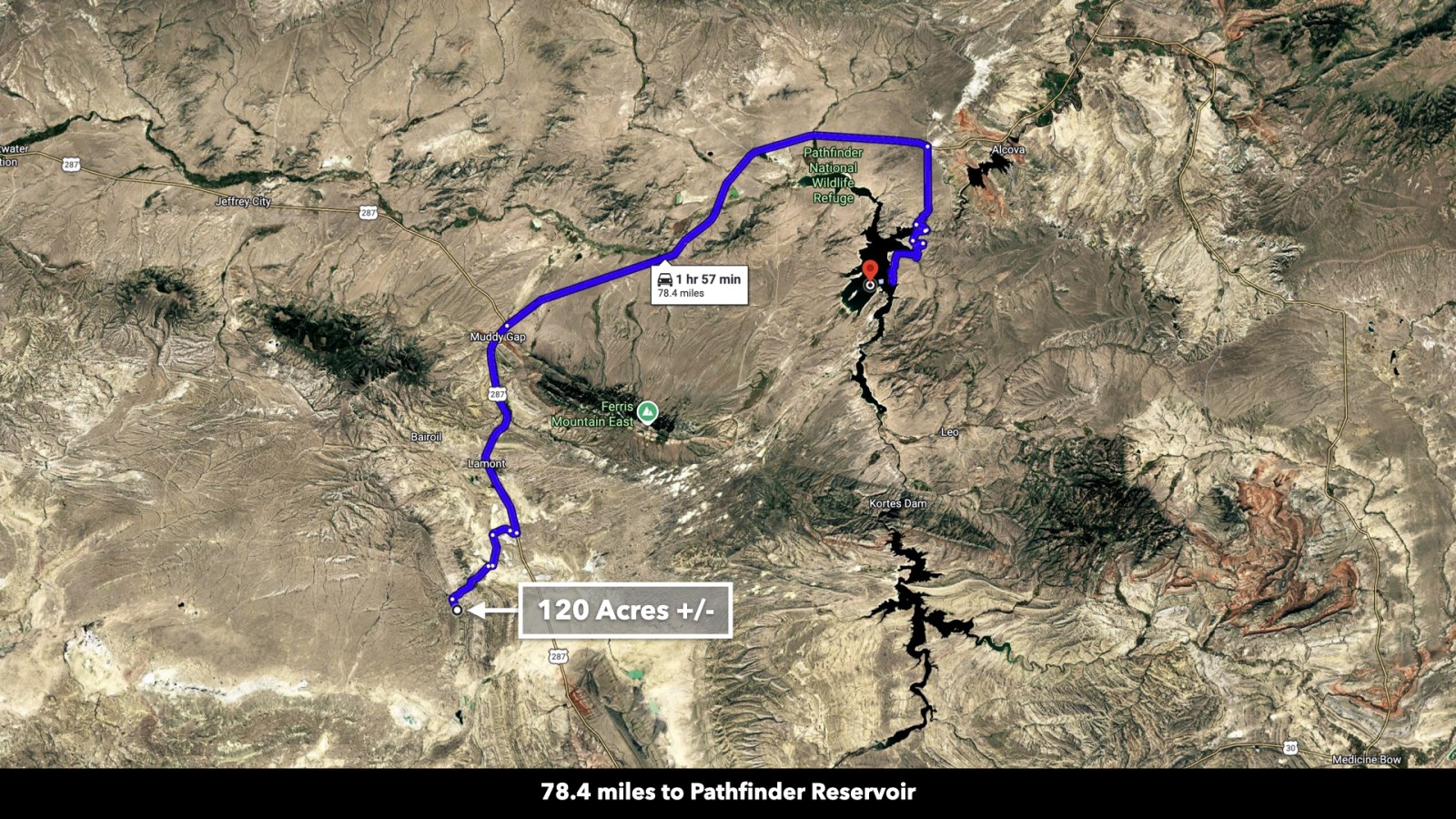
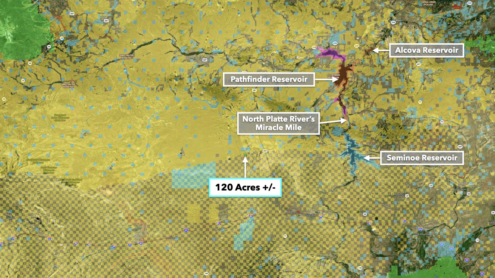
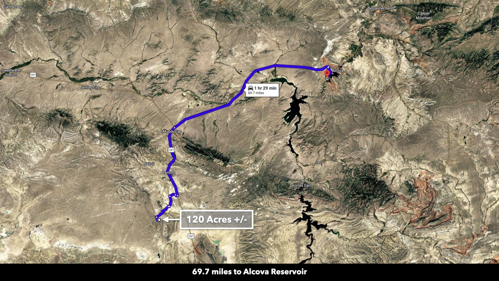
There are several nearby locations for fishing, floating, & water sports. To the east, the North Platte River runs through the Seminoe Reservoir and Seminoe State Park. North of the park, the Pathfinder Reservoir covers 22,000 surface acres for fishing and boating, and the Alcova Reservoir is also publicly available for fishing, boating, and water recreation.
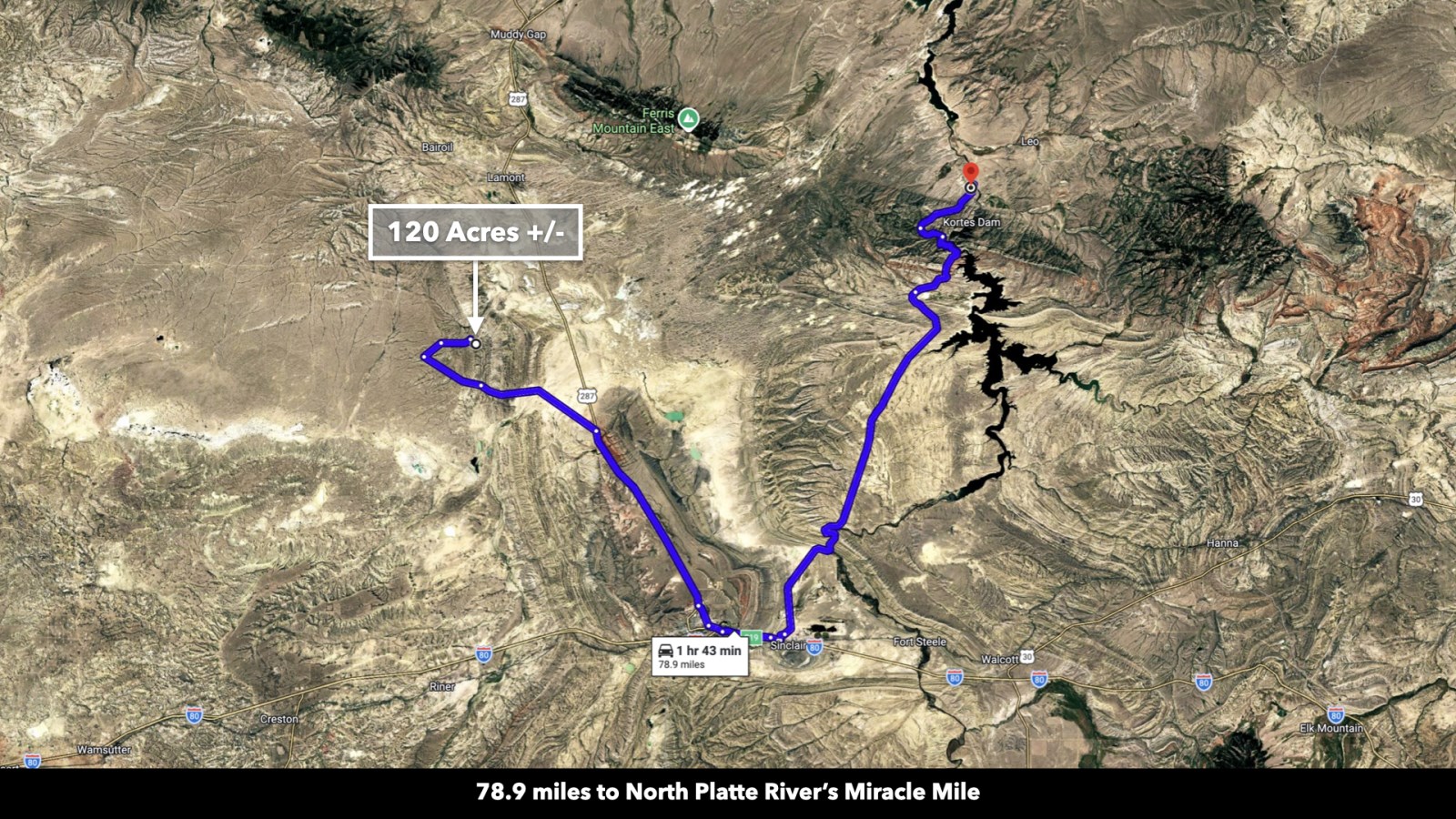
On the North Platte, the Miracle Mile is world renowned among anglers for trophy brown, rainbow, and cutthroat trout fishing, with about 4,000 fish per square mile along a 5+ mile stretch. The North Platte River is classified as a Class 1 Fishery. In addition to fishing, the North Platte offers floating, swimming, camping, and waterfowl hunting opportunities, too.
About 3 hours from the property, Seminoe State Parks features scenic lake shores, great fishing, endless hiking trails, and views of the Seminoe Mountains.
Property Specifications
LANDIO ID: Wy_Sweetwater_00012
Price: $70,000
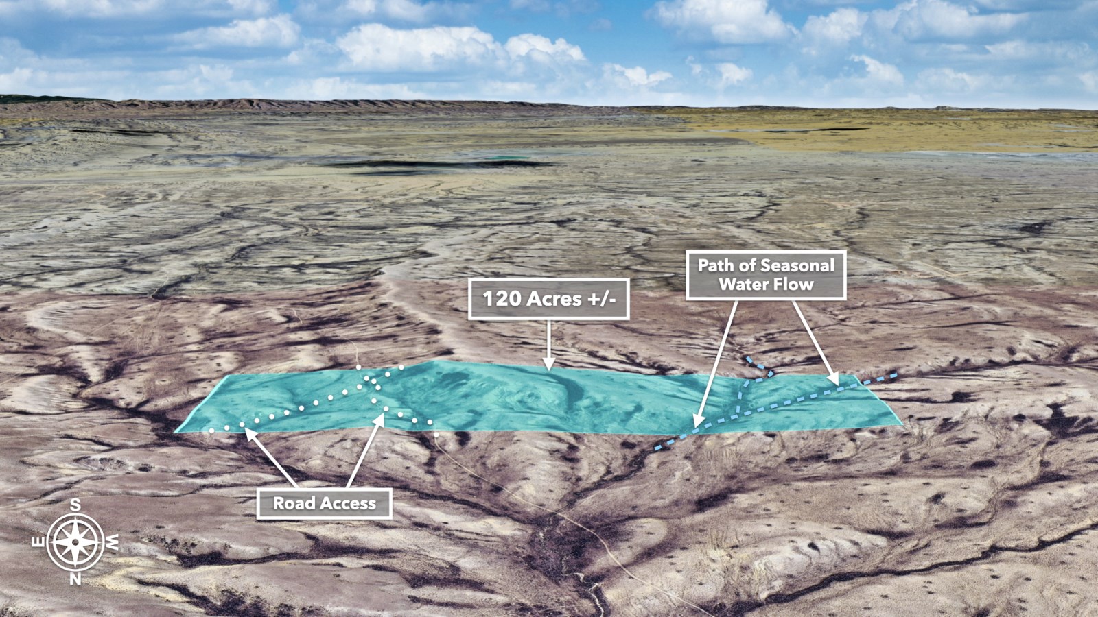
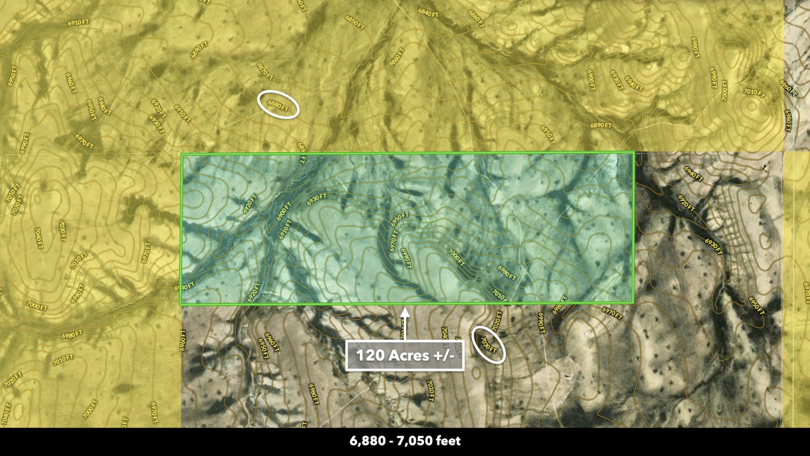
Parcel Size: 120 Acres +/-
Account Number: R0128714
Parcel Number: 04-2490-13-1-00-092.00
Legal Description: T24n R90w Sec 13 Nw4ne4 N2nw4
Access: Paved County Road 63 (Mineral Exploration Road) to Dirt Road
Property Taxes: $176 per year
Title: Free & Clear
Conveyance: Warranty Deed
Approximate Distance to Nearby Cities & Points of Interest
1.25 miles to Bull Springs Creek
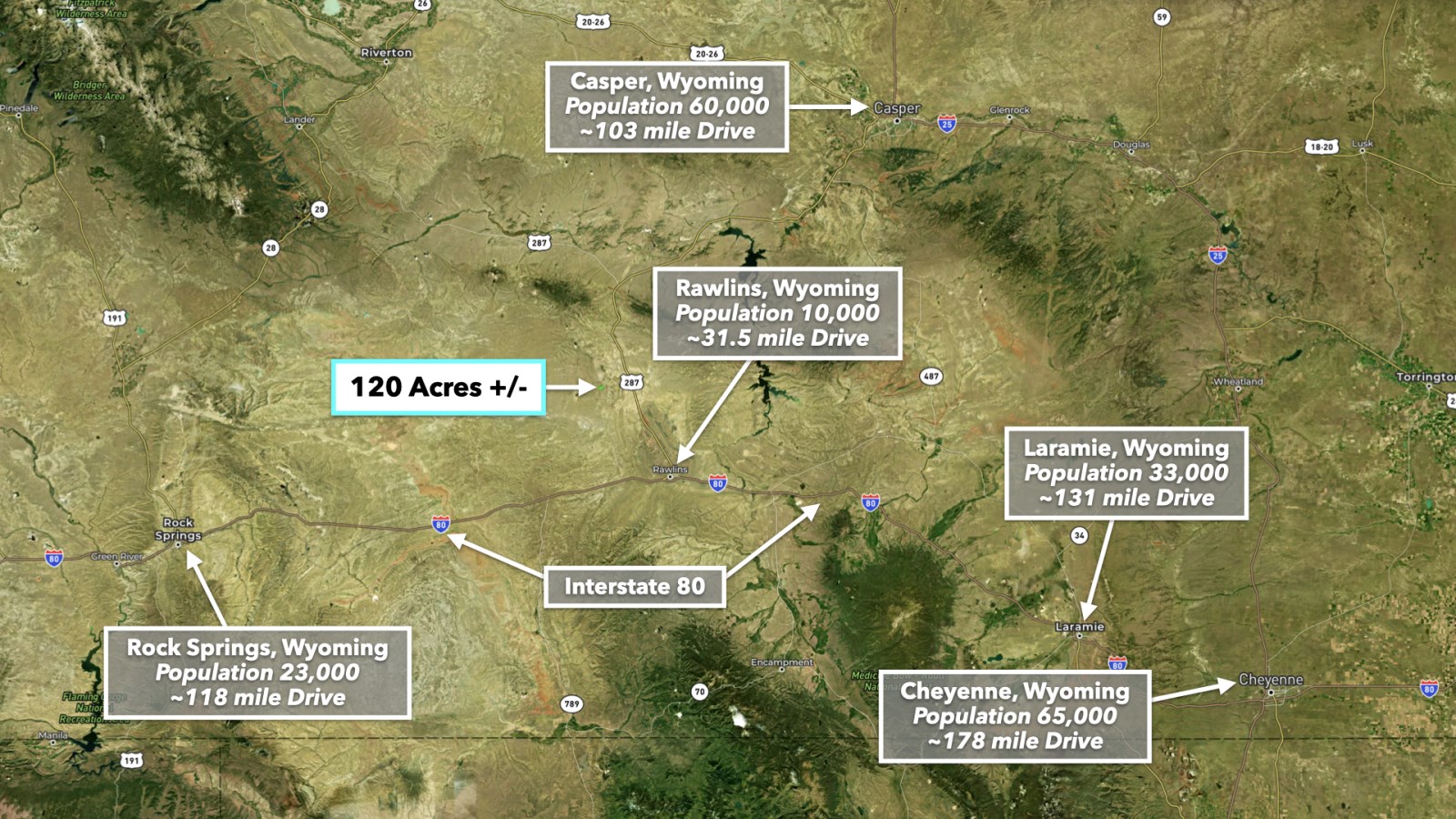
31.5 miles to Rawlins, WY : Population 10,000
69.7 miles to Alcova Reservoir
78.4 miles to the Pathfinder Reservoir
78.9 miles to North Platte River's Miracle Mile
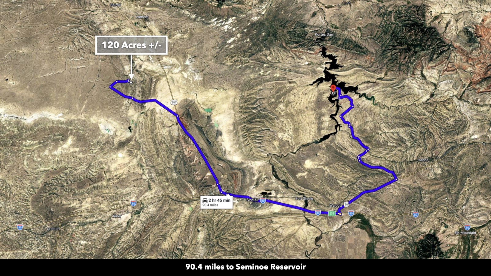
90.4 miles to Seminoe Reservoir
103 miles to Casper, WY : Population 60,000
There is an International Airport in Casper, Wyoming about 2 hours from the property. The code for this airport is Cpr. For more information, please visit their website at miles to Rock Springs, WY : Population 23,000
131 miles to Laramie, WY : Population 33,000
144 miles to Medicine Bow National Forest
178 miles to Cheyenne, WY : Population 65,000
258 miles to Denver, CO : Population 3,000,000
Visiting the Property?
To Schedule a Tour of the Property, Please Contact the Listing Agent Rebecca Williams by Call or Text anytime at:
Gps Coordinates (approximate)
Northwest Corner: 42.145, -107.52358824691
Northeast Corner: 42.619, -107.508972800812
Southeast Corner: 42.243, -107.509000753763
Southwest Corner: 42.535, -107.523645155927
Center Point: 42.057197, -107.516387
Farm Maps & Attachments
More Farm Details
More Farms from LANDiO
 15.7 AC : $133K
- 11.6 AC : $99K
- 186.5 AC : $373K
- 137 AC : $1.9M
- 40 AC : $160K
- 8.3 AC : $70.6K
- 800 AC : $1.1M
- 9.5 AC : $81.3K
- 15.9 AC : $136K
- 10.4 AC : $88.6K
- 37.2 AC : $205K
- 7.7 AC : $65.7K