Oversize Lot, Power, Great Access
4148 County Line Rd : Snowflake, AZ 85937
Navajo County, Arizona
Farm Description
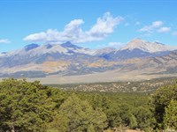
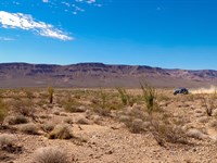
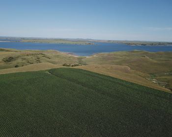
Wake up to wide-open Arizona skies on your own 13 acres of high desert land. This property sits in Navajo County, where the air is clean and the landscape stretches for miles. You're just a short drive from Petrified Forest National Park, where massive logs of crystallized stone and colorful badlands create one of the most unique landscapes on earth. Explore trails, hunt for fossils, and witness sunsets that paint the Painted Desert in colors you won't find anywhere else.
This land gives you the freedom to build your dream exactly how you want it. Set up your RV and camp under star-filled skies while you plan your next move. Build a traditional home, bring in a manufactured home, or go tiny-the choice is yours. Power poles already run along the north side of the property, so you're not starting from scratch. Whether you want a weekend escape or a permanent homestead, this is your chance to create something real.
Thirteen acres for a price that makes sense. No HOA telling you what you can and cannot do. Direct access from Cottontail Road means you can get here without hassle. This is Arizona land for people who want space, freedom, and the chance to live on their own terms. The opportunity is here-now it's up to you to take it.
We are open to owner financing as well - here is what that would look like:
- Total Money Down: $599($349 downpayment + $250 closing cost)
- Monthly: $419/Month for 84 months
See Info below.
- Subdivision: N/A
- State:AZ
- County: Navajo
- Zip:
- Size: 13.11 Acres
- Parcel: 403-40-001A
- Legal Description: Section 24,T13 N,R23 E: Portion Of Tract 1 D Beg Se Cor Of Sec 24; Th N10 Dg11'06 W 2684.24' Tpob; Th N10 Dg11'06 W 2690.89'; Th N88 Dg 20'35 E 13.45'; Th S01 Dg22'51 E 2605.62'; Th N88 Dg44'23 E 410.62' Tpob. Out Of 203 40 001 For '97
- Approximate Lat/Long Coordinates:
34.5169, -109.8565
34.5169, -109.8564
34.5097, -109.8548
34.5097, -109.8562
- Annual Taxes: Approximately 25.68/Year
- Zoning: Ru-20
--- Site built, manufactured, and factory built homes allowed
--- Mobile homes allowed (must be less than 20 years old)
--- Tiny homes allowed.
--- Short term RV Camping allowed. 30 days out of the year without a permit
--- Long term RV Camping allowed with permit (septic system required), permit is good for 120 days (can be renewed and extended to 240 days)
--- Once building permit obtained it
- Hoa/Poa: No
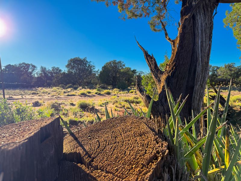
- Improvements: None
- Access: Cottontail Rd.
- Water: Would be by well
- Sewer: Would be by septic
- Utilities: Power poles at the North side of the property.
Note: Information presented on this page is deemed accurate, but is not guaranteed. Buyer is advised to do their own due diligence
Area Information
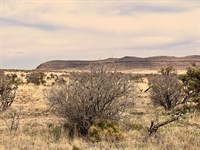
Navajo County spans a diverse landscape in northeastern Arizona, from high desert plains to forested mountains. Part of Petrified Forest National Park lies within the county, showcasing the colorful badlands of the Painted Desert and ancient fossilized wood logs ?. On the northern horizon, the iconic buttes of Monument Valley rise from the red sands ?, while in the south, the White Mountains are blanketed by one of the largest pine forests in America ?. This mix of wide-open spaces and rugged natural beauty defines the area's character, with big skies, clean air, and views that stretch for miles.
Area Highlights: Navajo County offers plenty to see and explore. Some highlights of the area include:
• Petrified Forest & Painted Desert: A national park known for 225-Million-Year-Old petrified wood and the multi-hued badlands of the Painted Desert. Spanish explorer Francisco Vázquez de Coronado was so amazed by the colors here in the 1540S that he named it “El Desierto Pintado” (The Painted Desert) ?. Visitors today can drive along I-40 and see these rainbow-striped mesas and buttes stretching over 150 miles from the Grand Canyon to the Petrified Forest ?.
• Monument Valley: The classic Wild West landscape of towering red-rock buttes. The Arizona side of Monument Valley lies in Navajo County on Navajo Nation land, featuring the famous buttes seen in countless western films ?. This sacred Navajo site offers driving tours and photo opportunities of mesas like the Mittens and Merrick Butte, especially stunning at sunrise and sunset.
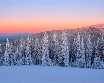
• White Mountains: High-elevation mountain country in the southern part of the county. This region is filled with cool ponderosa pine forests, clear lakes, and alpine meadows - a stark contrast to the desert. Towns like Show Low (elev. ~6,400 feet) enjoy four distinct seasons with mild summers and winter snow ?. Outdoor activities abound here, from fishing and hiking in summer to skiing at Sunrise Park Resort in winter. It's a popular getaway for desert dwellers looking to escape the heat ?.
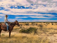
Navajo County isn't just about scenery - it also has a rich heritage. A significant portion of the county is Native American land (parts of the Navajo Nation, the Hopi Tribe reservation, and the White Mountain Apache reservation), so indigenous culture runs deep here ?. Long before any towns existed, this land was home to Native peoples whose traditions still influence the region today. By the late 1800S, the area became true cowboy country on the frontier. In fact, Navajo County's first sheriff (appointed in 1895) was Commodore Perry Owens, a legendary gunman known for taming lawless towns during the Pleasant Valley War era ?. The county seat Holbrook was once a rough-and-tumble railroad stop infamous for Wild West violence - an 1886 saloon shootout there was so bloody that the floor was said to be slick with a “bucket of blood,” a gruesome event that even gave a city street its name ? ?. Those rowdy days are long past, but their stories live on in local lore, museums, and annual festivals. Today you can stroll down Holbrook's historic Bucket of Blood Street or visit the old Wigwam Motel on Route 66, and feel the echoes of that Old West history in the air.
Monument Valley's iconic buttes on the Navajo Nation (northern Navajo County).
In modern times, Navajo County remains sparsely populated and rural, with friendly small towns providing the essentials. Holbrook and Winslow are the main hubs along Interstate 40 (Route 66), offering groceries, gas, schools, and hospitals - plus a dose of classic roadside Americana ?. Holbrook, once a rowdy cattle town, later became a Route 66 outpost and is known for its mid-century kitsch charm ? (think retro diners, neon signs, and petrified wood gift shops). Winslow, another historic town, gained fame from the Eagles' song “Take It Easy” - there's a famous “Standin' on the Corner” statue and park downtown commemorating the lyric about “standin' on a corner in Winslow, Arizona” ?, which draws visitors from around the country. To the south, the communities of Snowflake and Show Low offer more services amid the cool pines (Show Low even has big stores, golf courses, and an airport). Yet despite these towns, much of Navajo County feels peaceful and uncrowded. There are no big cities here - just vast open land and tight-knit communities. Neighbors know each other, and people value the freedom to live how they choose. On a clear night, you'll see more stars than you ever thought possible. It's the kind of place where you can enjoy true quiet, natural beauty, and a independent rural lifestyle - the perfect setting to live on your own terms, with plenty of space and freedom to spare. ? ?
Farm Maps & Attachments
Directions to Farm
From the town of Snowflake, head east on E 3rd St N/Snowflake Boulevard and continue for 2.1 miles.
Continue onto Concho Hwy (also marked as E Snowflake Blvd) and follow for 6.3 miles.
Continue onto Snowflake Concho Rd for about 380 feet, then continue onto E Concho Hwy for 5.4 miles.
Turn right onto Apache Rd and continue for 0.7 miles.
Turn left onto Morgan Ln (240 feet), which turns slightly right and becomes County Rd.
Continue on County Rd for 1.0 mile.
Turn left and continue for about 315 feet to the property on your right.