640 Acres, Access, Borders Blm Land
Fremont Canyon Road : Beaver, UT 84713
Iron County, Utah
Farm Description
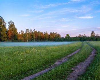
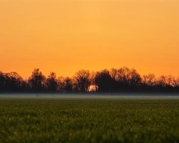
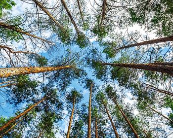
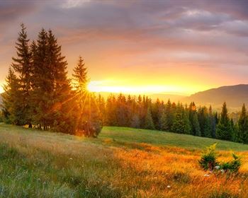
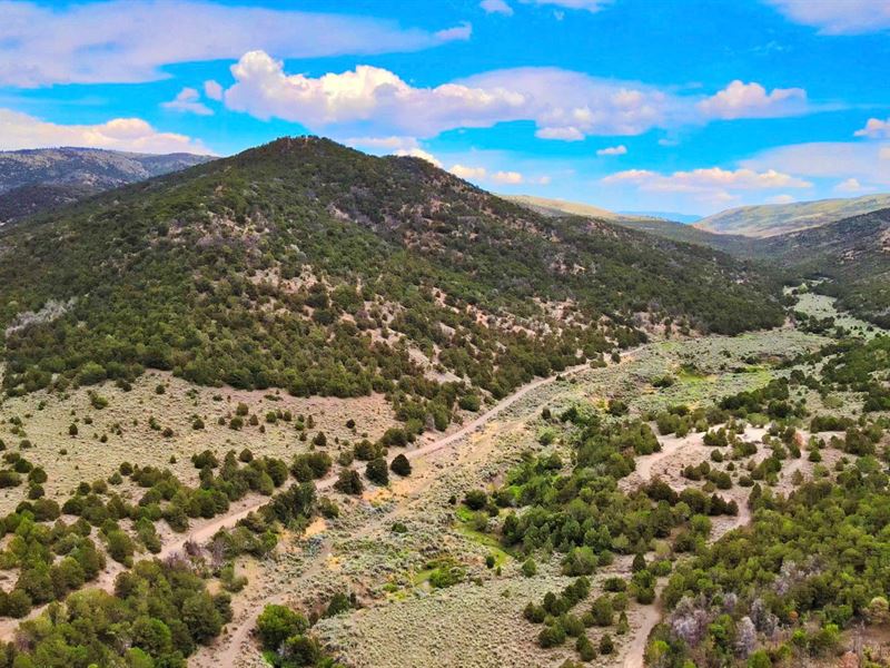
Enjoy pristine alpine beauty on 640 acres near Beaver, UT, bordering BLM land. Nestled on the slopes of Fremont Mountain, this property looks out over the breathtaking valley. This coveted location with panoramic mountain views is ideal for a mountain home, seasonal retreat, or hunting cabin less than an hour from the Eagle Point Ski Area. Perfectly spaced evergreens, junipers, and native sagebrush thrive on the mountainside for year-round beauty and vegetation.
Located along the rocky Tushar mountain range, you get a front-row seat to Utah's year-round beauty. As the third-tallest mountain range in Utah, this quieter, scenic range offers rivaling recreational opportunities away from the state's largest and busiest resorts.
Accessibility & Property Info
Away from the hustle and bustle of larger mountain towns, you can still hop on I-15 North to get to Beaver, Provo, and Salt Lake City. Provo is about 2.5 hours away, and Salt Lake City is slightly over 3 hours.
The property has approximately 1,055 feet of access on Fremont Canyon Road.
From I-15, take Fremont Canyon Road east for 7.3 miles directly to the property. Coyote Bench Road and Fremont Canyon Road (Fremont Iron County Road) intersect at the property's southwest corner.
Livestock is permitted, and nearby ranchers have a few cattleguards, gates, ATV trails, and fences along Coyote Bench Road and around the property.
For extra privacy and scenery, the northern boundary borders BLM land.
Fishlake National Forest is only 1.7 miles north of the property and is accessible by road along the eastern boundary of the property.
Recreational Opportunities
During the winter months, Eagle Point Resort in Beaver, Utah, is fun for families and experienced winter sports enthusiasts alike, with green, blue, black, and backcountry ski/snowboard trails available in season. Wind through the Tushar forests via snowmobile, take ski lessons, or try backcountry snowshoeing.
Zion National Park is also just an hour away and boasts some of the most scenic hiking trails in the state, with jaw-dropping canyons and towering red peaks.
Pull out your hiking boots during the summer months. Locals enjoy exploring Beaver's quieter, less-traveled mountain trails. Watch for wildlife, hunt, fish, mountain bike, kayak, or enjoy a scenic drive on a sunny day. The views never get old, and leaf peeping is spectacular in the fall. The mountains and landscape transform with each passing season, so there are always new sights and adventures to uncover.
The east and west sides of the Beaver valley feature distinct landscapes. To the east, discover miles of hiking and biking trails, camping areas, highland lakes, alpine ponds, rushing mountain rivers, aspen woodlands, and wildflower meadows. These mountain lakes and rivers are known for world-class trout fishing.
If you're up for a challenge, Beaver boasts the 23-mile Skyline National Recreational Trail for avid hikers and backpackers. The 12,000-Foot Tushar summits are nothing short of spectacular.
In addition to trout fishing, Utah offers hunting seasons for elk, mule deer, moose, pronghorn antelope, mountain goat & bighorn sheep, and upland game & turkey.
Experience Utah's Wild West near Frisco, just west of Beaver. This arid basin (aka Ramblers) is known for gem hunting for prized opal, blue beryl, and quartz in the Mineral Mountains, rock climbing and bouldering at the granite Milford Domes, trout fishing at Minersville Reservoir, and blazing trails through the Wah Wah Mountains.
Don't forget to take a ghost tour through Utah's historic Old West town of Frisco. The vacant Horn Silver mine was once the richest silver mine in the world.
Property Specifications
Parcel Size: 640 Acres M/L
Property ID: Ut_Iron_00001
General Elevation: 7,000 - 7,760 feet
Title: Free & Clear
Conveyance: Warranty Deed
Nearby Points of Interest, Towns & Cities
1.7 mile to Fishlake National Forest
18.9 miles to Beaver, UT : Population 3,600
13.7 miles to Dixie National Forest
31.1 miles to Parowan, UT : Population 3,200
46.5 miles to Cedar Breaks National Monument
49.5 miles to Bryce Canyon National Park
50.4 miles to Cedar City, UT : Population 35,000
67.7 miles to Zion National Park
101 miles to St. George, UT : Population 95,000
110 miles to Capitol Reef National Park
167 miles to Glen Canyon National Recreation Area
217 miles to Salt Lake City, UT : Population 200,000
Gps Coordinates
Northwest Corner: 38.115575, -112.515468
Northeast Corner: 38.115562, -112.497056
Southeast Corner: 38.101053, -112.497065
Southwest Corner: 38.101066, -112.515458
Center Point: 38.108361, -112.506469
Contact Information?
To speak with , please Call or Text us anytime.
Please Reference Property ID: Ut_Iron_00001
Do You Have Property to Sell? If So, Please fill out the simple form on our website.
You are welcome to visit the property while it is available. Please contact for instructions by Call or Text anytime.