Lily Pond Forest
Alstead, NH 03602
Cheshire County, New Hampshire
Farm Description
The property represents a considerable forested landscape that has been held as a long-term forestland investment. For the last 37 years, forest management has focused on concentrating growth on the best trees, resulting in a high-quality forest resource. Now, this land is being passed onto new owners that can benefit from the decades of previous high-quality silviculture while developing many of the property's highlights previously left untouched.
Property highlights include:
· Standing timber value of with outstanding asset appreciation opportunity and short term timber sale income;
· Developed internal access to support future forest management activities and recreational pursuits;
· Partial ownership of the secluded Lily Pond, with a scenic beaver pond near the town road frontage;
· Exceptional building sites near the land's quiet Pratt Road frontage with long views and subdivision opportunity.
Location
The forest is located in southwest New Hampshire and is part of the Cold River Watershed. One of the earliest areas of the state to be settled, there is a quintessential old New England feel to the landscape. Rolling forested hills are interspersed with fields and fine homes, many dating back to the late 1700S. The area's rich agricultural history is still evident by the number of old hill farms seen throughout. This region is anchored by Keene, New Hampshire to the south, a thriving college community that is within a 25-minute drive and provides shopping and cultural pursuits. Located within a 30-minute drive of either Interstate 89 & 91, a host of locations throughout New England are easily accessible. Both Hartford, Connecticut and Boston, Massachusetts are approximately a 2-hour drive. Pratt Road runs along a rural setting, mostly forested with well-kept, widely scattered homes. Of interest is the random metal artwork that is displayed along Pratt Road, likely the work of a local artist.
Access
The property benefits from excellent access with ample town-maintained road frontage. This, coupled with a solid internal road and trail system, allows for forest management entry, recreational activities, homestead options and even possible subdivision opportunities. In addition, two points of entry to the property exist from publicly maintained roads: approximately 1486' of frontage off Pratt Road (gravel town maintained road with low traffic flow) and nearly 1000' of frontage along Route 12A (state paved road with moderate traffic flow). The gated internal access road commences along Pratt Road and runs roughly 1.2 miles to a point near Lily Pond. This road is ditched with culverts but has not been used in nearly 20 years. The beaver pond near the beginning of the road has recently overflowed, crossing the road surface and preventing vehicle access until the beaver dam adjacent to the road is removed.
Site Description
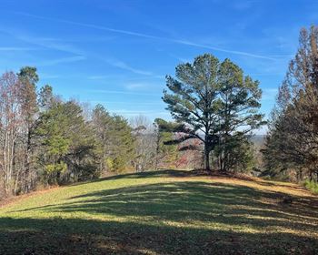
The land is generally situated at the highest elevation within the regional landscape; therefore, when tree clearing occurs, the views are long and scenic. Of particular interest are the possible long northern views near the Pratt Road frontage land, a viewshed visit-able from neighboring properties where clearing already exists. This northern end of the property, off Pratt Road, offers the best future homesite opportunity where slopes are gentle, access is easily developed, power is nearby, and views of the beaver pond along Pratt Road are easily established. This area also offers terrain that can be cleared for the creation of a meadow near a future homesite.
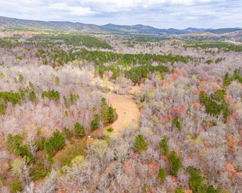
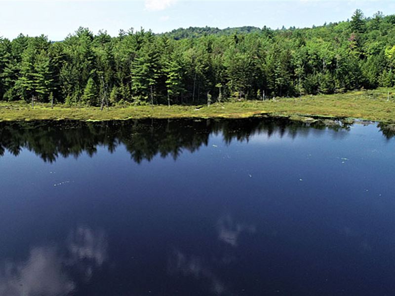
Lily Pond sits at the south-central area of the land, accessed by the internal access road. The center of the pond offers open water with the shoreline rimmed with various wetland species. The pond is ideal for wildlife viewing and paddling with a canoe or kayak. The forest has varied terrain, with gently sloping sites near the road frontage points, many level ridge tops, some steep slopes, and areas with rock outcrops.
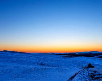
Overall, the elevation does not change much across the property, with the highest elevations at nearly 1,500' (generally along the center of the forest - south to north). The lowest elevations are close to 1,280' and located near the southern end of the land. While the elevation change is not very big, there are areas with sudden slope changes. This varied terrain offers all aspects (south, north, west and east). Given the land's high position within the landscape, only small streams cross the land, most intermittent.
Timber
Timber data is based on a comprehensive and monumented timber inventory completed in April of 2019 for the purpose of developing a management plan and establishing Capital Timber Value (Ctv). Upon applying growth for 2019-2021, the timber data reveal a total sawlog volume of 2,978 MBF International ¼” scale (6.1 Mbf/Acre), with 9,989 pulpwood cords (20.5 cords/acre). The combined total commercial per acre volume is 32.7 cords, a figure well above average for the region. Stumpage values were assigned to the volumes in September of 2021, producing a property-wide Capital Timber Value (Ctv) of acre).
The species composition is 3/4 hardwoods at 75% of total volume and softwoods at 25%. Species composition for all products combined mirrors that commonly found in the area, with red maple holding 23% of total volume, yellow/black birch (14%), sugar maple (12%), hemlock (10%), beech (10%), red spruce (8%), white pine (7%), red oak (7%), white ash (5%) and miscellaneous hardwoods completing the profile.
The sawlog volume breakdown is held by species with strong demand in the marketplace, with The Maples, red oak, black/yellow birch and white ash holding the majority of the hardwood volume. Softwoods are dominated by red spruce and white pine.
Since the tenure of the current owner began in 1998, forest management improvement activity has occurred on roughly 65% of the acreage. Over the last 10 years, thinnings and small patch group harvests, have been completed on roughly 50% of the acreage (southern and west-central areas). The current management plan calls for silvicultural improvement treatments over the next 10 years on nearly half the acreage generating enough income to easily cover holding costs over this period.
Forest density is generally represented by fully-stocked stands with 408 acres possessing fully to overstocked conditions (covering 6 of the 9 forest stands in the management plan), 31 acres holding overstocked conditions (within one forest stand), and 47 acres in a free to grow, stocked state (one stand).