Kemp Hill Forest
Kemp Hill Road : Canaan, VT 05903
Essex County, Vermont
Farm Description
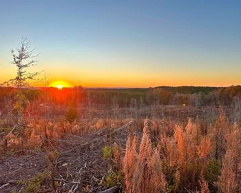
Located in the northern reaches of Vermont's Northeast Kingdom Region, the property is situated near the Connecticut River Valley, easily accessible from state roads. The road frontage provides for an easy building site with power nearby. Internally a woods road leads to a hilltop at elevation 1,660' where views with clearing are long. A Vast snowmobile trail runs across the land, providing direct access to this recreational amenity.
If you are seeking a recreational property, then please be sure to check out the details.
Location
Kemp Hill Forest is located in Canaan, Vermont, a small rural town bordered by Canada to the north and the Connecticut River to the east; truly the farthest point north and east in the fabled Northeast Kingdom.
Hemmed in on the west and south by thousands of acres of forestland, much of it conserved, and the river to the east, the town's history has long been associated with lumbering, farming and sawmilling. As the forest industry downsized over the past 40 years, back-country recreation has grown significantly in popularity to the extent that snowmobiling and all-terrain vehicle trail riding have now become major economic contributors to the region.
The forest is located about one mile south of the village, one mile west of Route 102 (which parallels the Connecticut River Valley), and just 7 miles from the Canadian border.
Montpelier (Vt) is located approximately two hours away, Manchester (Nh) is about three hours away, and Boston (Ma) is located about three and a half hours away.
Access
The parcel has about 250' of frontage on Kemp Hill Road, a gravel town road with power and utilities.
Boundaries are in fair condition, visible in the form of painted tree blazes.
To visit the property, from the intersection of Route 114 and Route 102 in Canaan, head south on Route 102 for about 1.25 miles and turn right on Kemp Hill Road. Travel another mile up a steady incline where you will see pink ribbons on the right, marking the parcel boundary. Park in the grassy area on the right from where a trail leads into the parcel.
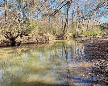
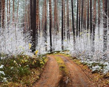
Internally, a woods road traverses the parcel, crossing over the central brook, to provide excellent access to the hilltop.
Site Description
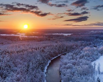
The parcel topography encompasses a small brook valley and a prominent knoll (1,660' above sea level (Asl)) in the northwest corner. Long-distance views from the knoll are available during leaf-less seasons.
An unnamed brook originates just west of the parcel and courses through the center. It likely runs for most of the year, but slows to a trickle during the summer. Its presence provides a scenic element and habitat for a host of wildlife.
Outside of the brook valley, soils are generally well-drained. The terrain ranges from nearly flat, particularly along the southern boundary and hilltop, to a moderately steep but short slope on the north side of the brook.
Development potential exists along the Kemp Hill Road frontage, where the soils and terrain appear most favorable. The internal woods road could be upgraded to access the knoll in the northwest corner for a very private, off-grid camp location.
Timber
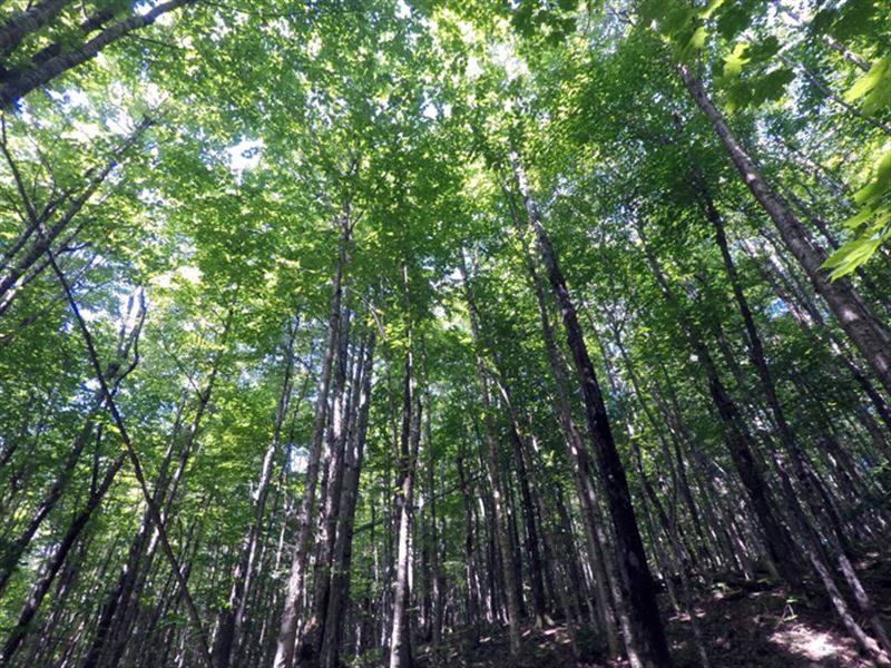
The forest is comprised of a 30 to 40-year-old mix of northern hardwoods, with a lesser mix of spruce and fir along the brook corridor. Given the young age classes, no commercial harvesting is recommended in the next 10 to 15 years, unless to create openings for views and to diversify wildlife habitat.
Signs of deer and moose are evident throughout the parcel. Black bear and smaller game, e.g. snowshoe hare and partridge, are likely present as well.
Average diameter for all products combined is 13.5”, while the average sawlog diameter is 15.5”. Average diameter for the main species are white pine 20”, sugar maple 14”, red maple 14.5” and hemlock 16”. The pine and hemlock volumes have reached financial maturity. The hardwood component generally remains in an asset appreciation growth phase.
Aside from the recent areas treated by a shelterwood harvest, forest density is generally represented by fully-stocked stands. The average basal area (Ba) is 103 sq ft on 185 stems/acre. Stem quality is quite good. Acceptable growing stock BA is 78 sq ft. The previously-thinned stands are currently in a free-to-grow state with no thinning activity required. The pine resource can be harvested anytime.