Lake Creek Ranch
Riesel, TX 76682
McLennan County, Texas
Farm Description
Property Description 1833.536+/- acres with a Huge Private 550+/- Acre Lake set amongst scenic rolling terrain heavily wooded in oak and elm forests. Clear right-of-ways, scenic elevation change and excellent building locations. Raw land with limited improvements allows for a blank canvas to with endless possibilities.
Area Historical Information McLennan County is deep seeded in history with the first Spanish exploring expedition in 1721 by Marques de San Miguel de Aguayo. Records show that during his expedition he camped near the Brazos River and a major tributary, Bosque, Spanish for woods.
Multiple native Indian tribes lived and roamed the area and was occupied by three main tribes - Caddo, Tonkawa and three branches of the Wichita - Tawakoni, Towash and Waco. The Tonkawas were the most predominant in number and referred to as Tonks by the European settlers. They lived in skin tents and followed bison, deer and other small animals. They were considered to be roaming hunter/gatherers which provided for many conflicts by the neighboring Comanche to the west.
Further settlement of the area began in 1837 when Fort Fisher, a Texas Ranger outpost, was established but abandoned a few months later. Waco Village was later built on the site of an ancient agricultural village of the Waco Indians. A two-league grant of land by Gen. Thomas J Chambers was the start of development in the area where land was sold for a dollar an acre. The Chisolm Trail later crossed at a shallow ford in the Brazos River where the town of Kimball was formed, west of Waco. In 1845, Neil McLennan moved onto land on the South Bosque River. In 1850, named after Neil McLennan, McLennan County was carved out of the Milam District and the same year Universal Immigration Company of England purchased 27,000 acres from Richard Kimball where 30 families were sent to settle the area. Bosque County was officially formed in February 1854 from McLennan County totaling 989 square miles. European settlers began to populate the area in 1854 when the State of Texas offered 320 acres to each family that would settle the new county, and Norwegians took advantage of the offer believing the area to be much like Norway. In 1856, Waco Village was incorporated as the town of Waco, and a new county courthouse was erected that year. By 1859, there were 749 people living in Waco.
Location Located in eastern McLennan County, Lake Creek Reservoir is on Manos Creek in the Brazos River basin approximately four miles west of Riesel, TX. It is located approximately 12 miles east of Waco, ~100 miles from Dallas/Fort Worth, ~110 miles from Austin & ~165 from Houston, Texas.
Directions From Waco, go East on Highway 6 toward Riesel. Prior to arriving in Riesel turn south on FM 1860 going approximately ~5 miles to the first main gate on the left. Just past this gate the lake can be partially seen on the left. FM 1860 continues around the ranch and ties back into Hwy 6 in Riesel, Tx.
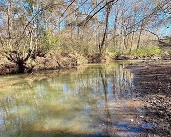
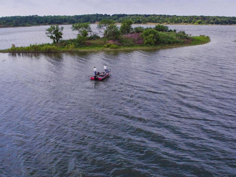
Lake Creek Reservoir This is a superior body of water constructed by Austin Road Company in 1953. There were no expenses spared at the time of construction. The water clarity is very good being in limestone based land. The lake is considered a magnificent recreational lake. There are 3 primary drainage basins with Manos Creek being the primary source of run-off water. The lake boasts multiple scenic coves, a magnificent tree covered island in the center of the lake, deep water shorelines and duck habitat in the backwaters of the lake making this an extremely versatile body of water in an area not known to have large lakes. Maximum depth is estimated to be ~35' at the deepest point with fourteen square miles of drainage feeding the lake. Based on aerial imagery from 2005-2015 the average water surface acreage was 442.475+/- acres with an average of 9.7+/- miles of lake frontage. Also based on aerial imagery, it is estimated that the lake fluctuated between ~343 surface acres and ~555 surface acres with only three of the last ten years being less than ~400 acres. Lake Creek is a desirable lake even at lower lake levels with some of the shorelines being gravel based and blossom with native grasses providing for a clean and scenic shoreline. Fluctuation of lake level is not believed to have any impact on the quality of the reservoir.
Lake Dam History A Water Right Permit dated May 10, 1951 was granted by the State Board of Water Engineers to Texas Power and Light for constructing the reservoir. Austin Road Company began construction on September 8, 1951 and the dam was completed May 1952. Impoundment of water began in June 1952 by runoff inflow from approximately 14 square miles. The first generating unit began commercial operation April 2, 1953. The dam is highly engineered and well-constructed with an estimated cost in 1952 of On January 26, 1972 the permitted water capacity was reduced from 9,500 acre-feet to its now current level of 8,500 acre-feet at 405 ft above msl. Lake Creek previously operated as a natural gas fired power plant which has since been completely removed and remediated. It was in operation from 1953 to 2010.
Water rights
Impoundment limit - 8,500 acre feet
Permitted Consumptive Rights - 10,000 acre feet
Maximum Make-Up Water per year from the Brazos River - 8,996 acre feet
Water is pumped via through a pipeline from a pump station located on the Brazos River in close proximity to the lake.
Dam Report Freese and Nichols, Inc conducted a dam inspection on July 18, 2017 and provided a report dated November 2017 of the Lake Creek Dam a full report can be made available to pre-qualified Buyers. The following is the Project Description Lake Creek Dam was completed in 1952 to provide a cooling reservoir for the operation of Lake Creek Steam Electric Station. The dam consists of a homogenous, earthen embankment with a length of 1,860 feet and a maximum height of 50 feet above the original streambed. Based on the 2003 inspection report, the dam's crest elevation varies from 409.75 to 410.25 feet-msl. The normal pool of Lake Creek Reservoir is elevation 402 feet-msl. The embankment has side slopes of 2.5 Horizontal to 1 Vertical 2.5H 1V for both the upstream and downstream slopes. The upstream slope of the embankment is protected by a 1-foot thick layer of rock riprap underlain by a 1-foot thick gravel bedding layer extending from the crest to elevation 395 feet-msl seven feet below normal pool elevation. A 4-inch thick layer of gravel protects the downstream slope. Lake Creek Dam originally had no internal seepage collection system however, a toe drain system consisting of a 6-inch perforated PVC pipe placed in a gravel filter and surrounded by filter fabric was installed in 2007 along the downstream toe of the embankment.
Discharge from the reservoir are controlled by two 20-foot tall by approximately 32.75-Foot wide radial gates at the left south abutment. The service spillway transitions into a 40-foot wide concrete chute, stilling basin, and outfall channel. The top elevation of the spillway gates is 405 feet-msl in the closed position, and the crest of the ogee weir at the gates is elevation 385 feet-msl. An uncontrolled earthen emergency spillway with a crest elevation of 406 feet-msl and a width of 523 feet is located in the right north abutment of the dam.
In Texas, the Tceq is the regulatory agency responsible for the administration of state dam safety laws. Dams are classified according to the size of the dam and the potential for loss of human life and property damages downstream from the dam in the event of a breach of the dam. The size classification of small, intermediate, or large is based on the storage in the reservoir and the height of the dam. Intermediate size dams are those with a maximum storage between 1,000 and 50,000 acre-feet and/or a height greater than 40 ft and less than 100 ft. With a height of 50 feet and a top of the dam storage of 11,700 acre feet Lake Creek Dam is classified as an intermediate size structure.
A dam's hazard classification can be low, significant, or high based on the downstream risks in the event of a failure. The area downstream of the dam consists primarily of undeveloped land in the floodplain of Manos Creek. Farm-to-Market Road 1860 crosses the spillway discharge channel downstream of the dam. The confluence of Manos Creek and the Brazos River is located approximately 0.6 miles downstream of the dam. Based on a visual review there are a few scattered homes located downstream of the dam however, they appear to be located at an elevation which would likely not be in the inundation zone. Farm-to-Market Road 1860 would be classified as a minor highway however, since it was observed to be as a school bus route, it would be considered a secondary highway. Tceq criteria define a significant hazard structure as one where failure can cause appreciable economic loss to isolated homes, secondary highways, minor railroads, and public utilities or which could potentially impact one to six lives or involve two or fewer habitable structures. Lake Creek Dam is currently classified as a significant hazard dam.
According to State criteria, an intermediate size, significant hazard structure is required to pass 56 percent of the Probable Maximum Flood PMF based on the height and storage parameters of Lake Creek Dam. As determined by an August 2013 hydraulic study performed by Fni, Lake Creek Dam passes 87 percent of the PMF event without overtopping the embankment. Therefore, the dam is considered hydraulically adequate.
Inspection Summary Report A full Freese & Nichols, Inc. report, dated November 2017, containing specific details in connection with minor repair recommendations can be made available to prequalified Buyers upon request.
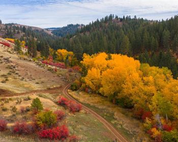
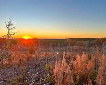
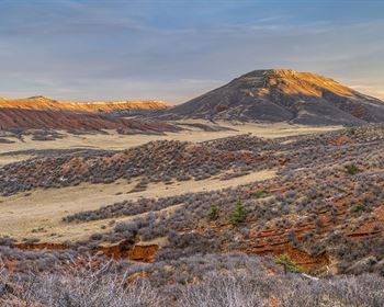
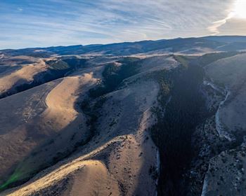
Terrain Terrain is scenic with ~120' of elevation change. Property is mostly treed with sporadic native pastureland desirable for grazing cattle. The landscape lends itself to be considered recreational land. There are highly desirable scenic views/building sites from the southernmost hilltops overlooking Lake Creek Reservoir.
Water Wells There are two known water wells on the property. One water well is believed to be ~685 feet producing approximately 248 gallons per minute gpm. The second well is believed to be approximately ~700 feet producing approximately 245 gallons per minute gpm. Neither of the wells are believed to operational currently but there is no reason to believe they could not be put back into use.
Other Surface Water Several small ancillary stock tanks exist as well as one small lake being approximately 3.5+/- surface acres that is partially shared with a neighbor.
Wildlife Wildlife is an untouched and untapped resource. There are whitetail deer, abundant dove, feral hogs, squirrels, bobcats, coyotes, and a variety of songbirds. Migratory waterfowl have been seen in large numbers, have never been hunted and use the lake as a wintering ground during peak migration being located just off the banks of the Brazos River, being a major flyway in the Central Flyway.
Fisheries While Lake Creek has never officially been stocked there seems to be an abundance and wide variety of fish species that have naturally been stocked and reproduced in the lake. The fish that were caught and observed while filming were largemouth bass, catfish and bluegill. The fish habitat and lake appear to be prime for fish management and additional stocking/management.
Fencing The perimeter is fenced and there is no functional cross fencing. Condition of the fencing is fair to good. A 6' chain-link fence was constructed below the dam and has been well maintained and presently in very good condition.
Access There are ten 10 gated access points into the ranch, all are secure and the lake is virtually unused. There are multiple heavy duty pipe entrances into the ranch. Manos Creek can be crossed on the east end of the ranch via a well-constructed concrete three culvert crossing.
Airports There are two airports in close proximity Lake Creek Ranch. Waco Regional Airport ACT is a full service airport located 5+/- miles NW of Waco and 22+/- miles from the ranch. It is a Class 1 Airport averaging 98 aircraft per day with two 2 runways measuring 6,596' and 5,896'. Additionally, Tstc Waco Airport CNW is located 8+/- miles NE of Waco and 15+/- from the ranch. The airport averages 131 aircraft per day with two 2 runways measuring 8,600' and 6,291'. Former President George W. Bush landed Air Force One at Tstc when visiting their family ranch during his presidency.
Hospitals There are three full service hospitals located in close proximity to the ranch. Hill Regional Hospital, Providence Health Center, Hillcrest Baptist Medical Center all located in and around Waco, Texas.
School District Riesel Isd
Electricity Oncor Electric, and Navasota Valley Co-op
Minerals Minerals are negotiable. Owner is believed to own a majority of the minerals on the ranch, but no warranties or guarantees will be made.
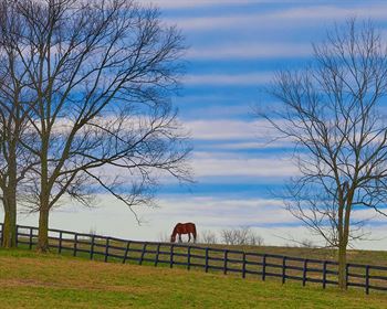
Grazing Leases The ranch is currently leased for grazing and hay production. Fishing and hunting have been prohibited during the current ownership.
Taxes Annual property taxes for 2015 were approximately and the property is agricultural exempt
Legal Description Estimated ~1833.536+/- acres in which a plat map and legal description of the property resulting from a boundary survey conducted in 2013 can be made available to prequalified Buyers.
Buyers & Brokers Buyer's brokers must be present for all initial showings. Buyers should notify Listing Broker that they are represented prior to touring the property. We welcome the opportunity to work with other Brokers/ Agents, but expect their full participation in any transaction.
Comments Rare opportunity to own a massive private lake in the heart of Central Texas close to Waco, TX and three major metropolitan areas.
Contact
- Partner/Broker, Mobile
Blake Hortenstine - Partner/Broker, Mobile